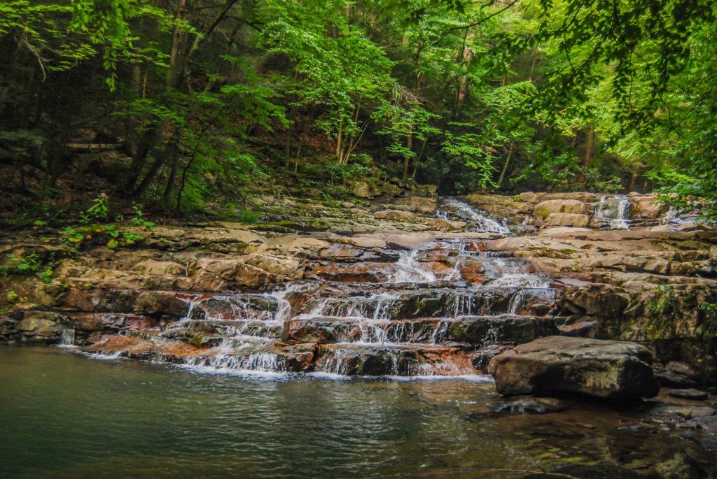
Potomac State Forest encompasses 11,535 acres. It is easy to lose your cares amid its hemlock and laurel. It is situated between the towns of Oakland and Westernport and partially borders the headwaters of the Potomac River. This rugged mountain forest is known for abundant wildlife, excellent trout fishing, and miles of multi-use trails.

About Potomac State Forest
Made up of mountain forests, streams and valleys, Potomac State Forest’s diverse habitat supports an abundance of wildlife, including wild turkey, white-tailed deer, black bears, fox and songbirds. The tree species typically found are that of an eastern hardwood forest. Plantations of white pine, red pine and spruce were also planted between 1950 and 1970. A spring walk through the woods will reveal flowering plants such as saxifrage, rue and wood anemone, spring beauty, May apple, blue violet and other violet species. Summer brings milkweed, spiderwort, mint, butterfly weed and dogbane to the roadsides and meadows. Ironweed, aster and goldenrod varieties brighten the fields in the fall.
The forest drains into the Potomac River Basin. It also features the highest point in Maryland – Backbone Mountain, elevation 3,220 feet. Another high point in the forest is the rock outcropping near the intersection of Maryland Route 135 and Walnut Bottom Road. It offers a scenic view of Potomac State Forest, Savage River State Forest and Crabtree Creek.
Fishing
In addition to fishing, visitors can enjoy the miles of scenic trails that are open for hiking, mountain biking, ORV use, horseback riding and winter sports. Bring your camera when you visit this untamed environment and capture the breathtaking views no matter what the season.
Famous for its trout fishing, anglers can test their skills on a generally fast running Potomac. The premier fish of this section of the river is the rainbow trout. Early spring through fall stocking provides incredible fishing opportunities. Other designated areas, including Lostland Run and Laurel Run also offer excellent fishing spots. Additional fish found in the Potomac and the creeks surrounding it include rock bass, sunfish and smallmouth bass. Because of fast running water and the primitive environment, fisherman should be prepared to negotiate strong currents, large boulders and fallen trees in the water.
Hiking
Potomac State Forest is a natural area that presents certain hazards, such as poison ivy, rocky and slippery trails, venomous snakes and biting insects. Be sure to dress appropriately. All trails and roads are open to hikers and mountain bikers. Remember, you are responsible for having the necessary skills, knowledge and equipment for a safe and environmentally sensitive visit. Some of the more popular trails include:
- Lostland Run Trail 3.5 miles –
moderate
Take in the scenic beauty of Cascade Falls while visiting this trail, which takes approximately two hours each way. Enjoy the rhododendrons and towering hemlock trees along this trail. At the trail terminus, a short spur trail leaves a gravel parking lot to the Potomac Overlook where splendid views of the river and pristine mountains can be enjoyed.
- Laurel Run Road 3 miles – easy
Mountain bikers and off-road vehicle (ORV) users will enjoy this dirt road that runs southward from its intersection with Wallman Road to its terminus near the Potomac River. Views from the road offer a chance to see dense areas of mountain laurel. The laurel’s bloom during the spring months. This road is also open to motor vehicles.
- Wallman Road 4 miles – easy
This mountain bike and ORV road travels downhill from Laurel Run Road to a small parking lot near the Potomac River. The forest cover in this area is ideal habitat for a variety of wildlife, including wild turkey, white-tailed deer and black bears. Hikers and mountain bikers can make a circuit back to their starting point by using the 3.5 mile Loop Road.
- North Hill Trail 2 miles –
moderate (no blaze)
This gravel road easily lends itself to mountain biking. Travel through the dense forest and enjoy the scenery year round – especially breathtaking views during the fall months.
- CCC Fish Rearing Ponds Trail easy (no blaze)
This is a short, easy hike through mixed hardwood forest. At the end, look closely and you will notice the subtle remains of several former, now dry, fish rearing ponds built by Civilian Conservation Corps members stationed at the “Potomac Camp” during the 1930s.
How to Get to Potomac State Forest
Directions: Follow Rt. 219 south to Oakland. Turn left onto Rt. 135 east. Travel to the intersection of MD Rt. 560. At the traffic light, turn right onto Rt. 560 south and travel 3 miles to Bethlehem Road. Turn left on Bethlehem Road and travel 2 miles to the intersection of Bethlehem Road and Eagle Rock Road. Turn right, staying on Bethlehem Road for 1.4 miles. Turn left on Combination Road and travel 1/2 mile. Turn left on Potomac Camp Road and travel 1/2 mile to the Forest Resource Center, which will be on the left.
For more information visit https://dnr.maryland.gov/forests/Pages/publiclands/western_potomacgarrettforest.aspx or call (301) 334-2038.


